Thank you for your patience while we retrieve your images.
Home
»
Historic Route 66
Uploaded
19-Nov-09
Taken
19-Nov-09
Visitors
16
« Previous
Next »
916
of
955
photos
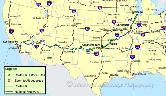
2map_8_18
NPS Map showing the official historic sites along Route 66. The green dots represent the sites. This is an interactive map. Click on the link shown below to open the map in your browser.
http://www.nps.gov/history/nR/travel/route66/maps66.html
© Copyright 2009 Fred Henstridge Photography