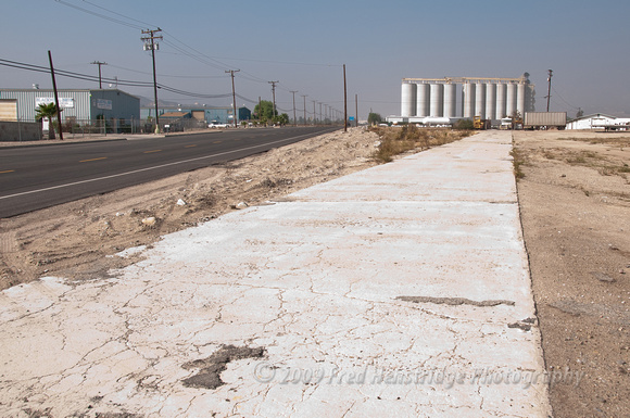
Looking northerly along a pre 1926 section of route 66 near Devore. Post 1926 route 66 (Cajon Blvd.) runs to the west (left). This concrete slab section is a mere 16 feet wide and carried two way traffic. The BNSF Railway lies to the east by about 50 yards.
http://maps.google.com/maps?q=34.19443833,-117.37149333&spn=0.001,0.001&t=k&hl=en